
Showers and Isolated Thunderstorms Increasing Overnight With Greatest Flood Risk In Rio Grand Plains According to NWS
Periods of steady light to moderate rain are expected through early Tuesday for much of South Central Texas. Rainfall totals are expected to be in the 1 to 4 inch range with pockets of higher amounts up to 6 inches. This is expected to be a long duration steady rain event. Therefore the threat for flooding across most areas remains low. There is a potential for flooding concerns mostly highlighted in and around the dashed area. However for most this will be a very welcome and beneficial rain.
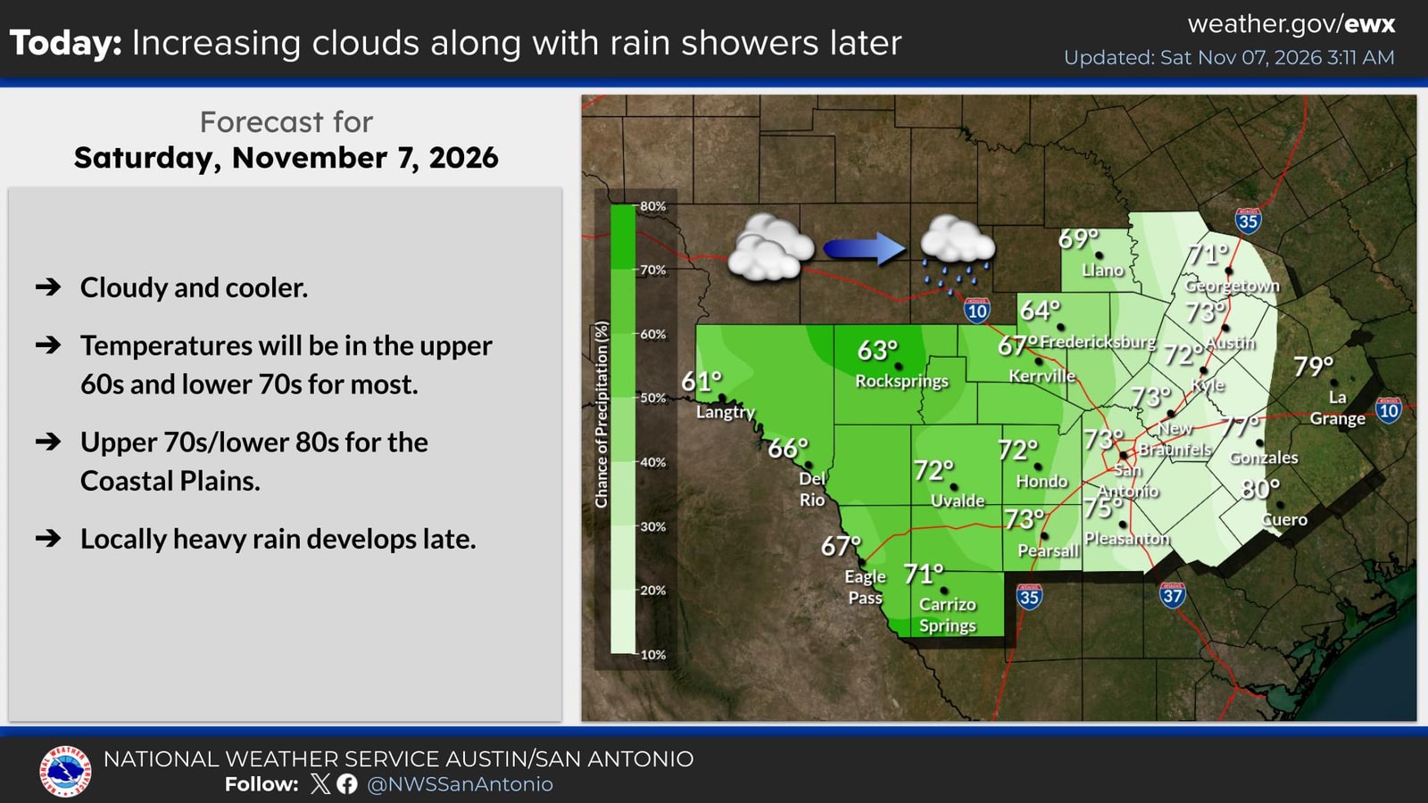
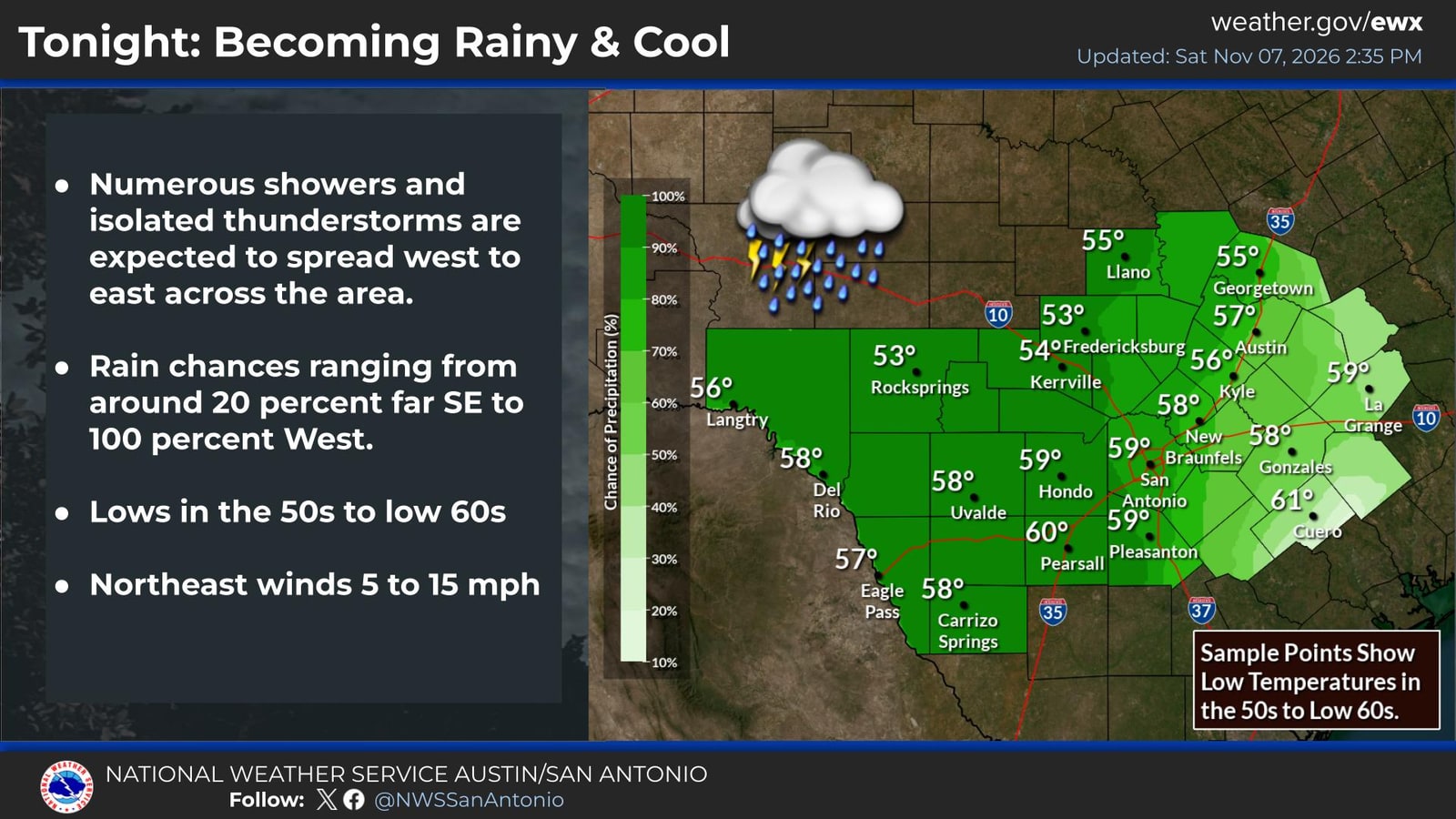
A good soaking rain will begin tonight and continue into Sunday. Lows will become a bit chilly, in the 50s to low 60s as northeast winds increase slightly to 5 to 15 mph. A few heavy downpours are possible.
Loading the interactive…