No FEMA, Just Fault Lines Under Joe Herring's Wrecked Bridges
Two flood-destroyed Kerrville sites -- the historic Arcadia Loop bridge and a stretch of Town Creek Road -- each sit within a tenth of a mile of a separate, independently mapped fault carrying more than 500 feet of throw.
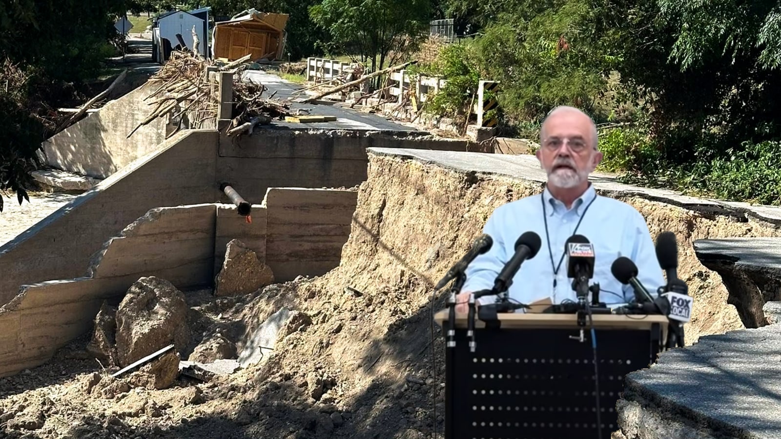
KERRVILLE, Texas — As Kerrville area catastrophic flood survivors are sleeping on mattresses in their destroyed homes if they are lucky, and are going into their seventh week awaiting FEMA Disaster approval, two of the flood-destruction sites Mayor Joe Herring Jr. has photographed since the July 15–16 flood sit within a few hundred feet of a mapped geologic fault. They are not the same fault. They are two different faults, from the same state structural survey, each one landing almost exactly on a separate site of catastrophic damage.
The public was never outright told about these faults. Kerrville Breaking News has searched relentlessly through City documentation for these faults and the closest mentions we could find were in one sentence in 2014 in a water conservation plan and a citation buried at the bottom of page 31 of a long-range water plan.
When you dig deep enough, as with any investigation, you start getting to the root, and Kerrville Breaking News (not the stolen version that Joe Herring promotes his feel-good emotional stories on, but the version that made its name rooting out corruption and bringing bad deeds to light) has found something that no-one in local government has told you about, but some readers may find it relevant to our current situations.
The historic Arcadia Loop bridge over Goat Creek — its roadbed sheared away, its rail posts scattered in the debris field — sits 0.04 miles from a fault the state's own Groundwater Availability Model documents at more than 500 feet of throw. Two miles east, where the storm gutted a stretch of Town Creek Road down to its buried sanitary sewer line, a second fault of the same magnitude passes 0.09 miles away.
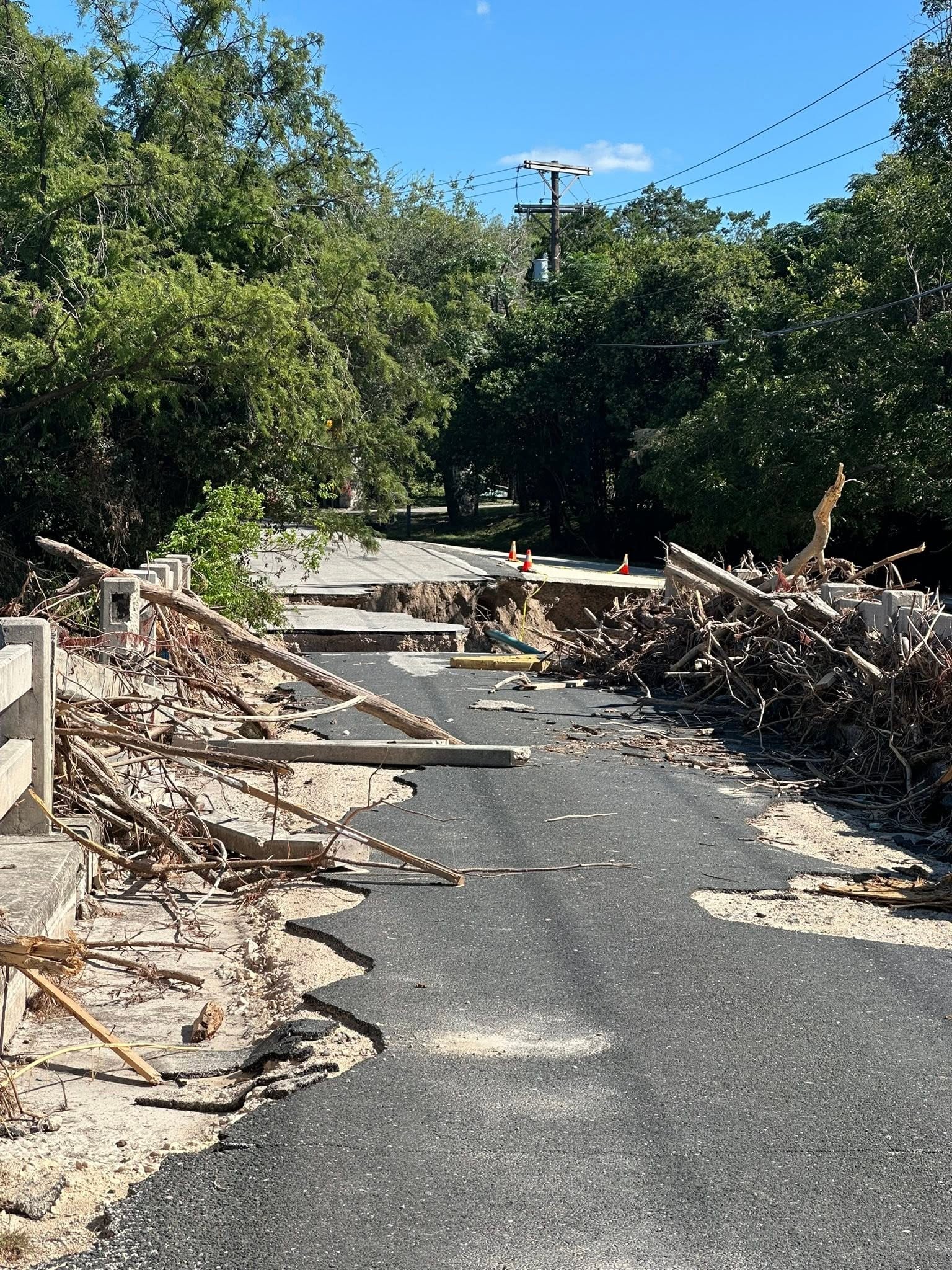
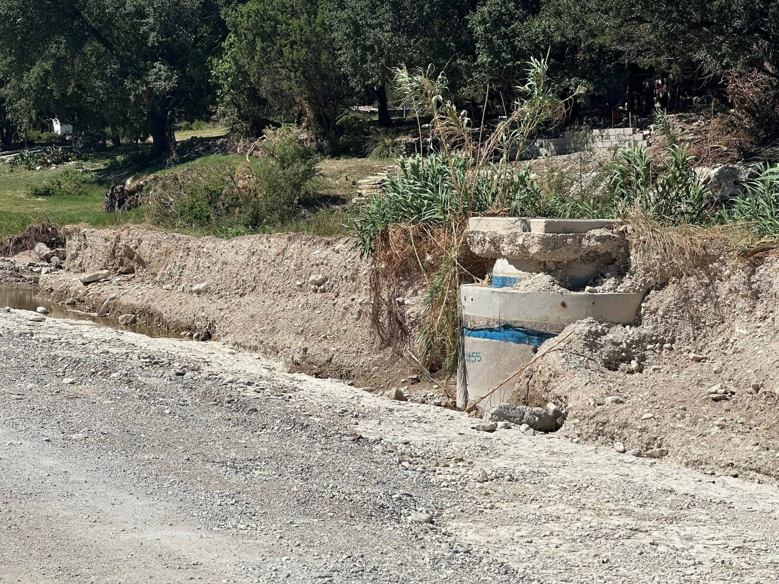
"A small section of damage along Town Creek Road from the July 16, 2026 flood," Herring wrote, posting the images publicly. "Those structures are from the sewer line; the tops were the manhole covers flush with the roadway."
Two different faults, one pattern
That's not a single line on a map. The map above shows the seal's actual thickness across the area on its own, read the same way -- node by node, off the state's own model, not smoothed between real control points. Set it beside the fault map above: Fault #7, the one nearest both ASR wells, runs through exactly the ground this map shows going from a functioning seal to none at all.
What the record already showed
The city's own filings anticipated this. In August 2014, the City of Kerrville adopted its Water Conservation Plan Update -- Resolution 26-2014 -- and filed it with the Texas Commission on Environmental Quality. Buried in its background section, describing the same Trinity aquifer these faults cut through, the plan states:
"Because of fractures, faults, and other hydrogeologic factors, the upper, middle and lower Trinity aquifer units are often in hydraulic connection with one another and should collectively be considered a leaky aquifer system."
That's the City's own language, on record with the state, eleven years before the July 2025 flood: fractures and faults connect the aquifer's layers to each other. It isn't a claim from this investigation. It's the operator's own filed description of the ground its ASR wells inject into.
The same month, the city was settling a lawsuit over a well that had already gone wrong underground. In 2010, Kerrville tried to drill a third ASR well. During construction, a drill bit and a 23-foot steel collar broke off and lodged at the bottom of the 600-foot hole; the well was never completed. The city sued its driller, C&C Groundwater Services, its engineering firm, CH2MHill, and the bond insurer, in 2012, alleging improper drilling and negligent oversight. The driller's defense, on the record: the city had ordered casing set 40 feet deeper than recommended, sealing off water-bearing rock the driller says it had advised against isolating. The case settled confidentially in August 2014 -- the same month as the water conservation filing above -- with the city paying nothing, the driller receiving a six-figure sum, and no party admitting fault.
Neither document mentions Goat Creek, Town Creek, or either of the faults this story is about. But both were filed in the same city, about the same aquifer, in the same month -- one describing the ground as leaky, the other showing what happens when a well built into it goes wrong.
The paper trail runs further than that, and closer to the source. The City's 2018 Long Range Water Supply Plan -- prepared for Kerrville by HDR Engineering and finalized in January 2020 -- cites the exact 2007 structural fault study behind this reporting, by name, author, and contract number, in a reference table on regional aquifer characteristics: "Standen, A. and Ruggiero, R., 2007, Llano Uplift Aquifers Structure and Stratigraphy," with a direct link to the state's own PDF of the report. Whoever prepared that table had the fault maps in hand while writing the City's water supply plan. The word "fault" does not appear anywhere else in the plan's 128 pages.
What hasn't been said
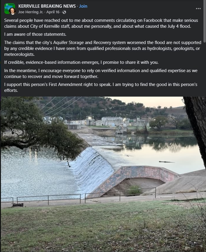
Mayor Joe Herring Jr. has addressed the broader claim once. In an April 16, 2026 Facebook post in this publication's stolen flagship Facebook group, he wrote: "The claims that the city's Aquifer Storage and Recovery system worsened the flood are not supported by any credible evidence I have seen from qualified professionals such as hydrologists, geologists, or meteorologists," adding that he would share any "credible, evidence-based information" if it emerged. He has not, in that post or anywhere else located for this story, addressed geological faults specifically, the Hammett Shale, or the two damage sites documented above -- none of which had been mapped in this form when he wrote it. The City's own official flood information page covers road closures, debris pickup, shelters and recovery resources; it does not address what caused the flooding at all.
The fault data comes from a 2007 state contract study — Llano Uplift Aquifers: Structure and Stratigraphy, prepared for the Texas Water Development Board — the same structural mapping that underlies the state's Hill Country Trinity groundwater model. It documents dozens of subsurface faults across Kerr County, each ranked by throw, the vertical displacement of rock on either side of the break.
Two of the largest — both ranked at greater than 500 feet of throw — run through the immediate area where the July 2026 flood did some of its worst road and infrastructure damage:
The fault beneath Arcadia Loop runs 45 miles, crossing Goat Creek three times near the bridge, the Guadalupe River itself, and Turtle Creek to the southwest. An older, independently digitized 1991 survey of the same structure — accurate to within about a kilometer by its own stated precision — places its trace within 0.24 miles of the bridge, tightening the case.
The fault beneath Town Creek Road runs even farther — 54 miles — and its southwestern end sits almost exactly where Town Creek meets Goat Creek, before running northeast across Quinlan, Third, and Cypress Creeks in a nearly straight line.
Neither fault is a minor feature on a map. Each is documented at more than 500 feet of vertical displacement in the Hickory–Ellenburger rock beneath the county — among the largest structural breaks mapped anywhere in this stretch of the Hill Country.
What else sits along them
The fault beneath Town Creek Road runs within about six-tenths of a mile of both of the City of Kerrville's Aquifer Storage and Recovery injection wells — ASR-1 at the water treatment plant, and ASR-2 on Hays Street, 0.59 miles away by the coordinates in the well's own permit — the wellfield the City normally uses to pump treated river water underground each winter and recover it later during dry periods -- though its own Class V operating reports, filed with the state, show it injecting daily through the week leading into July 4, 2025: 0.18, 1.26, 1.42, 0.77, and 1.30 million gallons on June 29 through July 3, and 0.58 million gallons on July 4 itself, the day of the flood. A 1934 oil test well four-tenths of a mile off the same fault logged black shale at 572 feet, the same kind of confining layer this investigation has spent months mapping across the county.
The fault beneath Arcadia Loop runs directly beneath a line of at least twelve perennial springs along the Guadalupe River's main stem — including two springs residents did not see before the 2025 flood, which have flowed since. A public water system with a documented history of radionuclide violations, the Blue Ridge Mobile Home Park, sits just over half a mile from the same trace. A 1952 oil test drilled to 4,881 feet sits about two-thirds of a mile from it as well.
Both faults, independently checked against the state's own groundwater model rather than an interpolated display map, run for roughly three-quarters of their length through the corridor where this investigation's ongoing analysis shows the Hammett Shale — the clay layer that normally confines the county's deep aquifer — is not merely thin, but absent by the model's own accounting.
The narrower silence -- on faults, on the Hammett Shale, on these two sites -- hasn't been directly answered by anyone. But the broader ASR claim has drawn a public rebuttal from elsewhere. Each weekday morning before his video podcast, Louis Amestoy, creator of The Kerr County Lead meets with Mayor Herring at Pint & Plow Brewery, where the mayor briefs him on each day's talking points.
The Kerr County Lead published a piece by Louis Amestoy on April 3, 2026, addressing the broader claim that the City's ASR wells contributed to the 2025 flood. His central argument doesn't rest on a number of his own. Both figures are this outlet's: the more than 60 billion gallons that moved through the South Fork during the flood, and the roughly 1.05 billion gallons the ASR system had in storage on July 3, 2025, both reported here first. Amestoy's contribution is the arithmetic sitting between them -- 60 billion is 57 times more than 1.05 billion, presented in the same reporting without, in his reading, ever being reconciled against each other. He also describes the Lower Trinity Aquifer, where the ASR wells inject, as "separated from [the surface] by a hydraulically tight confining layer of calcareous mudstone and shale."
One sentence from The City of Kerrville's own 2014 Water Conservation Plan contradicts Louis Amestoy's description of the Lower Trinity aquifer.
"Because of fractures, faults, and other hydrogeologic factors, the upper, middle and lower Trinity aquifer units are often in hydraulic connection with one another and should collectively be considered a leaky aquifer system." - Kerrville 2014 Water Conservation Plan
But, beyond that, both points are answerable. The storage comparison tests a claim that isn't the one being made. Amestoy's arithmetic assumes the ASR system's 1.05 billion gallons of tracked storage would have to be the source of the 60 billion gallons -- a straight mass-balance test, water in equals water out. That's not the mechanism described. It was still used and shared in the stolen Kerrville Breaking News Facebook group in a manner that ultimately bought enough time for another catastrophic event to occur without the public catching on.
The claim is about pressure, not volume: 27 years of injection didn't need to grow into the flood's full volume, it needed enough force to open a path -- a fault, a thin or absent seal -- and let out water that was already there. Pop a cork under enough pressure and what comes out is whatever the bottle already held, not the pressure itself. The 1.05 billion gallons is the force that found the weak point, not a claim about how much water came through it, and an arithmetic test built on that substitution doesn't reach the argument that was actually made.
That wasn't the only unfortunate outcome of the ASR's destructive pattern of subsurface artificial manipulation in a fractured Sligo aquifer unit. These injections over 28 years, created a trackable pressure wave that moves from Rocky Creek in south Kerr County northeast to Nimitz Lake, then laterally to northern Kendall and southern Gillespie county toward Old Number 9 bat cave.
Kerrville Breaking News has been tracking this pressure wave since it was discovered in early March.
- July 4, 2025: The groundwater hydraulic head was rising in the Lower Trinity and Middle Trinity formations for weeks leading up to the catastrophic flooding event.
- May 27, 2026: The groundwater hydraulic head wave was in southern Gillespie and northern Kendall counties the morning a house exploded on Serenity Lane killing an older couple. The initial projection by media was a propane explosion, but investigators have not released the cause of the explosion as of yet.
- July 16, 2026: The groundwater hydraulic head was traveling southwest toward the south fork of the Guadalupe River and was centered between Goat Creek and Town Creek. The overall damage estimate is over $100 Million, according to Assistant City Manager, Michael Hornes.
There are caves all along these fault lines, and not just near the surface. Some of the caves in the lithology logs are over 1,000 feet deep, specifically in the upper South Fork area.
The caves are mapped in the component shown above in this article. The area is riddled with cavities and voids, countless lithology logs saying "lost circulation" and caves, which are negative spaces that are full of water, depending on the water table. The water table rose between 12 and 15 feet near the south fork between the last week of May 2025 and the last week of June 2025 with not enough rain in the area to cause any rise at all. There was however, artificial manipulation of a karsted subsurface in the name of Aquifer Storage and Recovery.
Amestoy's own numbers raise the same problem he's pointing at, on their own terms. He cites "more than 12 inches of rainfall over the south fork watershed in less than 24 hours" and never converts it to a volume to check it against the 60 billion gallons he also cites. Twelve inches over the South Fork's 98 square miles is about 20.4 billion gallons; even stretched generously toward the full week's rain, it tops out near 35 billion. Either way, it's less than half of the 60 billion gallons he says moved through the same river. His own article cites a flood volume and a rainfall total that don't reconcile with each other -- the same gap this investigation has been documenting, sitting unexamined inside his own citations. And the "tightly sealed" description is the one place this investigation has run its own direct test: checked against the state's own groundwater model, node by node, using the model's own activity flag rather than an interpolated display map, the Hammett Shale is not thin in the corridor these two faults run through. It is absent, by the model's own accounting.
And then there are the HEC-RAS runs, the USGS program designed to model flooding events that fall short every time when the MRMS data and the 1m LiDAR data are inputted and ran. The story from the City of Kerrville and the raw data are just simply not in alignment with each other.